FAQ – Upstate New York Hikes

I will be driving. Where can I park, and what time should I expect to find you there?

We have never used a car to reach these trails. We recommend parking near the train station. Unfortunately, we do not have any information regarding parking lot capacity, fees, or any other details.

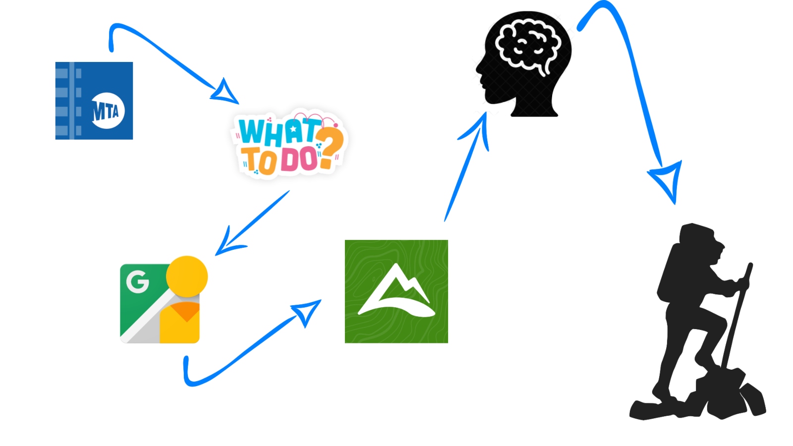
As for the timing, the meetup description mentions the train departure time. You can check the arrival time using the TrainTime App. You can download the iOS version here or the Android version here, or you can also check it on their website.

Train Station: Hike Name

  1. Appalachain Trail: Cats Rock.
  2. Beacon: Beacon Firetower.
  3. Beacon Falls: Toby’s Rock.
  4. Cold Spring: Bull Hill, Breakneck Ridge.
  5. Garrison: Sugarloaf.
  6. Manitou: Anthony’s Nose, Popolopen Torne.
  7. Millburn: Fairy Trail.
  8. Peekskill: Blue Mountain Reservation.
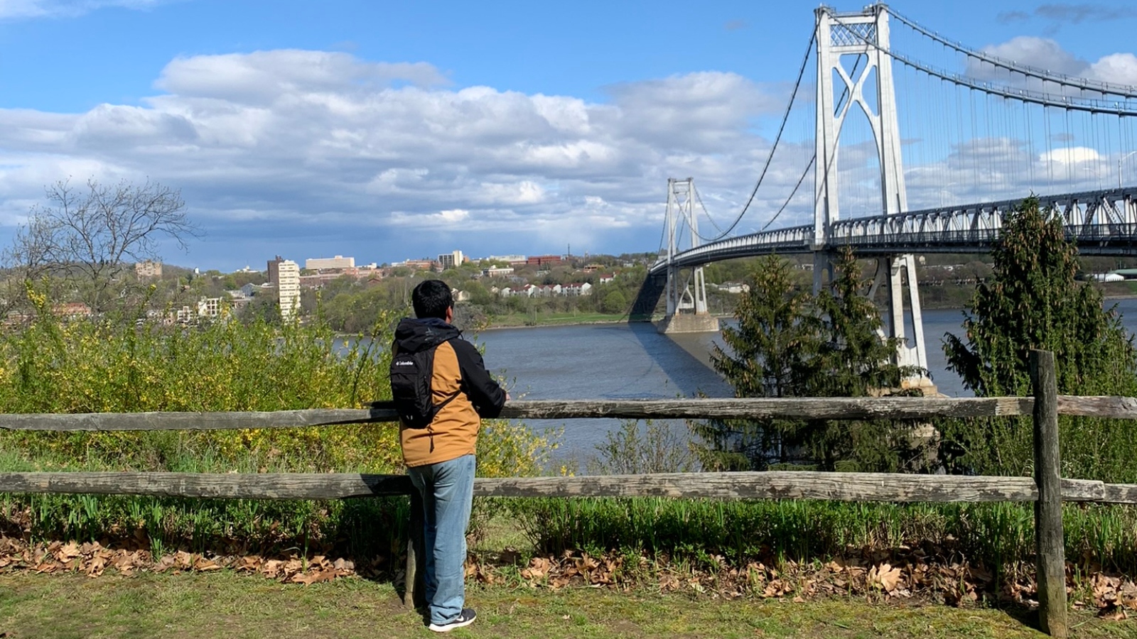
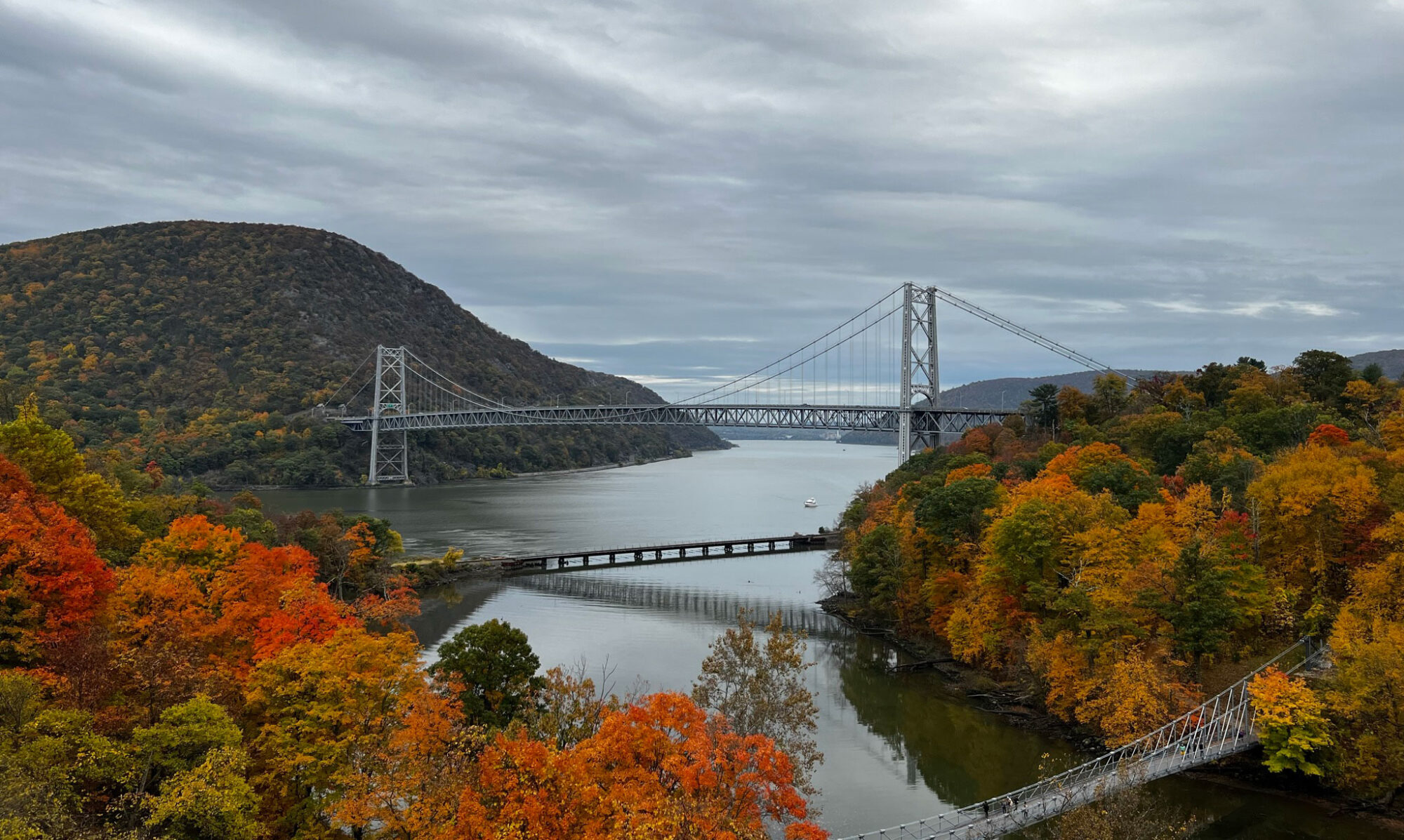
  9. Poughkeepsie: Walkway Over the Hudson, Mid-Hudson & Franny Reese Park.
  10. Tarrytown: Rockefeller State Park, Governor Cuomo Bridge.

Which path are we going to take?

We track all our trails using AllTrails. You can download the iOS version here or the Android version here. To view the trails, you must have an AllTrails account.

This are the paths we will follow.

  1. Anthony’s Nose.
  2. Beacon Firetower.
  3. Blue Mountain Reservation.
  4. Bull Hill.
  5. Cats Rock.
  6. Fairy Trail.
  7. From Beacon to Cold Spring.
  8. Popolopen Torne.
  9. Rockefeller State Park, and Governor Cuomo Bridge.
  10. Sugarloaf.
  11. Toby’s Rock.
  12. Walkway Over the Hudson, Mid-Hudson & Franny Reese Park.

I’ve never have hike, what do I need to wear or take with me?

We recommend wearing hiking shoes, sunglasses, and a hat. Additionally, please bring repellent, water, and snacks, as the group will have lunch at the trail’s summit. Don’t forget to check the weather forecast to ensure you wear appropriate clothing.

I am a beginner, is this an easy hike?

In the meetup description, all levels of difficulty are mentioned. Please keep in mind that the perceived level of difficulty varies from person to person; therefore, if you’re a beginner, it may seem more challenging to you than to others.

Can I buy the train tickets at the train station? Where Can I buy the train tickets?

  1. TrainTime App: This is the official app for buying tickets. You can download the iOS version here or the Android version here
  2. Grand Central: Ticket offices and automatic machines are available at Grand Central. If you choose this option, please arrive at Grand Central early to allow enough time for your purchase.
  3. Onboard the Train: While it’s possible to buy tickets on the train, I’m not certain whether they accept credit cards and/or cash. However, it’s worth noting that purchasing tickets onboard is typically more expensive.

The train ticket doesn’t tell the time, how do they know which train I would ride?

The ticket doesn’t need to display the train time because:

  • If you purchase the ticket through the TrainTime App, you will need to activate it when boarding the train.
  • If you buy the ticket at the ticket office, you will need to present it to the ticket checker on the train.

Outdoor Activities in Poughkeepsie

After discovering the tools to explore cities outside of New York, I began to feel like an expert in the art of exploration, fearlessly venturing into new places brimming with adventures.

Now, it was time to visit the city farthest from New York City that the Hudson line of the Metro-North Railroad allowed me to reach: Poughkeepsie.

This city is located two hours away from New York City by train. I always recommend sitting on the left side of the train, as this side offers stunning views of the Hudson River—simply spectacular.

I arrived in Poughkeepsie on a chilly morning under clear skies, brimming with excitement to explore its charming streets and iconic bridges. This city is renowned for being home to the ‘Walkway Over The Hudson,’ a museum-like bridge, offering breathtaking vistas of the Hudson River and its picturesque environs. The scenery comes alive with vibrant hues during the autumn, lush greenery dominates the landscape in the summer and spring, while winter drapes it in a white blanket; it’s a visual delight in every season of the year. On my inaugural visit, I strolled across the aforementioned bridge, as well as the ‘Mid-Hudson Bridge,’ both of which provide unparalleled panoramic views of the city and its surroundings. I also seized the opportunity to explore the ‘Locust Grove Estate,’ an oasis of nature with minimal foot traffic, providing a serene and tranquil experience. I’ll soon be sharing the route to reach it from the station; although it’s a lengthy journey, the rewards are absolutely worth it. During my initial visit, I had yet to discover the ‘Franny Reese State Park,’ an omission I rectified on my subsequent visit. Despite being a relatively short hike, it offers incredibly gratifying natural surroundings for those seeking an escape from the city.

Poughkeepsie holds a special place in my heart as it was the first destination for my Hiking Meetup group, which has since garnered widespread acclaim. I extend a warm invitation for you to join our hiking meetups and events here.

  • From Grand Central Station you must buy the train ticket to Poughkeepsie.
  • The price of the round trip train ticket for adults is US$51.50 dollars in peak and US$38.50 dollars in off-peak.
  • The duration of the trip, one way or return, is two hours, so it is better to go early to enjoy the city as much as possible. • For more details on prices, schedules and other details, I recommend reading “How to Look for New Hikes in New York?“, where you will find all the tools I use before visiting each place.

What to do in Poughkeepsie?

You must take in mind is that I always look for outdoor activities and I will talk about them in all my articles.

  • 360º Degrees of Discovery: Also known as the “Greater Walkway Experience”, it is a 4.5 mile (7.2Km) walk that allows scenic views of the Hudson River and its surroundings in a unique way. This experience has three main attractions; 1. Mid-Hudson Bridge, 2. Walkover the Hudson and 3. Poughkeepsie Waterfront. It is the closest attraction to the train station. The route map can be found here. You can find the route that I followed including the state park here.
  • Franny Reese State Park: It is one of the smallest state parks I have visited, its total route is approximately 2 miles (3.2Km), to enter it you must be attentive since after having crossed the “Mid-Hudson Bridge” Coming from Poughkeepsie, the entrance is in the right side and will take you under the bridge. This is a fairly easy state park to get around.
  • Locust Grove Estate: It is the furthest attraction from the train station, remember that I do all my adventures without a car, therefore, I have to walk to the attractions. The walk is 2 miles (3.2Km) from the train station to the entrance of this attraction, during the time that I visited this place for the first and only time I did not use AllTrails so at the moment I do not have the route that I walked, but soon I will go again and provide you with such information. Anyways, you can find the map of the farm here.

Definitely there are more interesting places to visit in Poughkeesie like the Frances Lehman Loeb Art Center, Cunneen-Hacket Arts Center, Bardavon Opera House, Barrett Art Center, Clinton House State Historic Site and more. but as I mentioned at the beginning of the article and I always say, all the attractions that I will talk about in my blog will be related to outdoor activities.

I hope all this information is useful and you can enjoy an unforgettable day visiting Poughkeepsie.

Beacon Mount and Beacon Firetower

After my initial adventure in Peekskill and my discovery of ‘Street View’ on Google Maps, along with other tools I mentioned in a previous article, I’ve become more adept at organizing my trips. 

Beacon is a captivating city nestled in Dutchess County, about 60 miles (97 km) to the north of New York City. This particular journey had me brimming with excitement, as it marked my first foray into mountain climbing, promising a breathtaking view of the Hudson River. It’s a hike I’ve frequented extensively due to its numerous routes, each offering distinct panoramic vistas of the Hudson River and its picturesque surroundings. On my inaugural visit, I was accompanied by my nephew, Josenrique, providing me with a sense of security on the trail. Subsequently, I ventured there again, this time with my other nephew, Sebastián, and together we traversed the mountain, ultimately reaching the magnificent Breakneck Ridge – an unforgettable experience. This season, I’ve had the pleasure of revisiting Beacon Mountain twice with the Meetup group.

Now, I’ll provide you with a comprehensive guide on everything you need to know to visit Beacon Mountain and its firetower, ensuring you can fully relish this remarkable experience.

How to get to Beacon Mountain? 

  • You must purchase a ticket train from Grand Central Terminal to Beacon.
  • Price: $ 35.00 dollars. Round Trip.
  • Check the train Schedule here.
  • The distance from the station to the Beacon Mountain entrance is 1.8 miles (2.8 km), which will take you approximately 40 minutes to walk. Here the route I took.
  • In addition, there is a bus service available to transport you to and from the entrance of Mount Beacon Park. The entrance to the mountain is located at bus stop 3, and please note that this bus operates only from Monday to Saturday. You can access the route and schedules here.
  • About the route I took, you can find it here.

About Beacon and its FireTower

  • At the entrance of the hiking trail, you’ll find a portable toilet, although I couldn’t find one during the winter season. However, in autumn, it’s typically available as it’s considered prime hiking season. For the rest of the year, I cannot confirm its presence.
  • Beacon Mountain offers several routes, including one that connects to Breakneck Ridge, spanning the entire mountain, but we’ll delve into that another time. I would categorize its routes as ranging from moderate to difficult in terms of difficulty. Beacon is located at the top of the map, which you can view here.
  • The shortest route to the summit is quite steep, but there’s no need for any climbing equipment. Follow the red route (CT – Casino) and then switch to the white route (BR – Breakneck Ridge) leading to the Firetower. You can see the route here. If you continue along this path, you’ll eventually traverse the entire mountain, but that’s a tale for another article.
  • Right in front of the entrance, you’ll find a deli where you can prepare for your hike by purchasing sandwiches and beverages.

How to Discover New Hiking Trails in Upstate New York?

After publishing my second article sharing my adventure in Peekskill and offering recommendations to fully experience its beauty, I find it essential to share the tools I use for my explorations and how I gather information about them. My goal is to assist you on your own adventures.

First and foremost, it’s crucial to remember that our most reliable travel companion for these initial journeys in Upstate New York is the Metro-North Railroad, along with its TrainTime app. So, let’s begin there.

Train Time (*)

  • This app saves you a significant amount of time searching, so I strongly recommend having it on your cell phone. With it, you can access schedules, determine whether it’s peak or off-peak(**), follow the train route, identify its stops, and purchase tickets.

What to do in…?

  • When I open the TrainTime app, I typically search for the final station of each route, allowing me to view all the stops along the way. This helps me explore ‘What to do in name of the train station.’ While you’ll usually find numerous activities in each city, my focus is primarily on outdoor activities, especially hiking.

Google Maps

  • Who isn’t familiar with Google Maps? It’s an incredibly handy application when exploring new places. However, there’s a particularly helpful tool within it called “Street View.” This feature allows you to preview the route you’ll be taking, which can be especially beneficial if there’s a sidewalk along the way. In many residential areas, there may not be adequate walking space or a designated area for pedestrians on the road. I mention this because all my adventures are undertaken via train, and quite often, you’ll need to walk to reach your desired destination.

AllTrails (***)

  • This amazing app provides hiking trails. With the free version, you can select a route, and the app will show your position relative to that route. This feature is incredibly helpful in preventing you from getting lost and also provides information about the route’s difficulty. However, please note that if you lose your signal, you won’t be able to access the map again. The paid version offers a solution to this issue by allowing you to download the maps, enabling you to access them at any time, even without an internet connection.

Common sense

  • This is the most crucial tool you’ll need. It’s not an application or something that can be obtained digitally or in print. Instead, it’s your common sense, which is invaluable when transitioning from the virtual world to the actual hiking route. Exercise caution and avoid taking unnecessary risks, especially if access to a place seems highly restricted. Pay close attention to signage, and be aware that some areas may be private, potentially leading to legal issues if you trespass.
  • Furthermore, it’s essential to show respect for the environment. Leave the area in the same condition as, or better than, you found it. Carry bags for your trash and refrain from disposing of ‘organic’ waste like fruit peels. Different natural spaces have their own unique ecosystems, so it’s best to hold onto such waste until you can properly dispose of it in designated garbage facilities.

I hope these tools prove useful for your adventures, and that nothing will hold you back when you decide to embark on new journeys.

(*) You can download TrainTime at App Store or Play Store.

(**) Peak refers to the rush hour and this has a higher price due to its demand, while its off-peak counterpart is a time of low demand and its prices are lower. The application tells you if the schedule you want to take is in peak or off-peak therefore, you know what price you must pay.

(***) You can download AllTrails at App Store or Play Store.

Peekskill: My First Adventure in Upstate New York

Only true nature enthusiasts can truly appreciate that, after spending three months in the city, my body was yearning for its dose of adventure, greenery, and a deeper connection with Mother Earth. That’s when someone introduced me to the enchanting “Blue Mountain Reservation,” nestled in Peekskill, Upstate New York.

Peekskill, situated approximately 50 miles (80 km) north of New York City, is accessible via the Metro-North RailRoad departing from Grand Central Terminal. The journey takes just over an hour, and as is often the case in the United States, the towns on the outskirts of major cities exude a sense of serenity and tranquility. They are excellent places to escape the routine and rediscover nature’s beauty.

I fondly recall my first visit to this place, which was in the company of some family members. We inadvertently took a scenic detour, adding about 40 minutes to our journey. Although we eventually reached our destination, Blue Mountain Reservation, we didn’t have as much time to explore it as I had hoped. The group was fatigued from the unexpected detour. Since then, whenever I venture to a new place for the first time, I prefer to go solo. This way, I can fully immerse myself in the experience without worrying about navigation. I enjoy that sense of “discovery”; getting ‘lost’ in an unfamiliar place presents a thrilling challenge, a chance to uncover new facets of the world that make me feel truly alive. However, I understand that not everyone shares this perspective, which is why I’m here to provide you with all the necessary information to ensure your visit to “Blue Mountain Reservation” is seamless and allows you to savor this remarkable place to the fullest.

How to get to Blue Mountain Reservation by train? 

  • You’ll need a train ticket to get to Peekskill. You can purchase the ticket through their app, which you can find on the App Store or Play Store. It will provide you with an e-ticket, or you can buy the ticket directly at Grand Central Terminal.
  • You can check the train schedules either on the app or here.
  • The distance from the station to the Blue Mountain Reservation entrance is 1.4 miles (2.3 km), which will take you approximately 30 minutes to walk. Here is the route I took.
  • When you’re in Blue Mountain Reservation, you have the freedom to choose your path. You can find a map of the area with its trails here. here, or you can follow my route on AllTrails here.

About Blue Mountain Reservation

  • At the entrance of the reserve, usually there are some maps available that you can take to guide yourself inside. The digital and printed maps display colored markers corresponding to the trees in the reserve. These markers will help you identify your route during your walk.
  • I’m an avid hiker, so for me, this route is suitable for beginners as there are no steep slopes, and you can choose short paths.

Escaping of THE CITY

My name is Victor. I’m Peruvian, and I love engaging in outdoor activities. I studied tourism and hospitality management because I have a passion for travel, meeting new people, learning about their cultures, and, above all, exploring new places. A little over a year ago, I moved to a new city, and that’s when my adventure truly began.

New York City is a fantastic place to live; there is always something new to do and discover. It boasts incredible attractions with spectacular views, such as “Little Island,” “Central Park,” and “High Line,” just to name a few. There are also iconic viewpoints that offer a 360-degree perspective from above, like “Top of The Rock,” “One World Observatory,” or the recently opened “Summit One Vanderbilt.” The list of things to do and places to visit in the city that never sleeps seems endless.

However, after three months of living in The Big Apple, my body began to yearn for nature. I felt the need to reconnect my soul with outdoor activities, far from the city’s stress and noise, escaping the concrete jungle and immersing myself in the tranquility of a green landscape. Nature was calling me.

I inquired with many people about where I could go hiking, find nature, and escape from the bustling city. The answer came to me swiftly – Upstate New York. It was a revelation that filled me with joy, uncovering the existence of places like Anthony’s Nose, Breakneck Ridge, or Beacon Mountain and its Fire Tower. It was quite a surprise, considering New York’s reputation as a cosmopolitan metropolis. However, following the initial excitement, the million-dollar question loomed: How could I reach these places? The answer remained consistent: ‘You must have a car.’ While this response didn’t offer immediate help, it certainly didn’t deter my determination.

Eventually, someone mentioned a nearby hiking spot – Blue Mountain Reservation in Peekskill. They reassured me that it was within reach and a car might not be necessary. In my quest for this location, I stumbled upon the ‘Metro-North RailRoad,’ and that’s where my adventures truly began. Peekskill holds fond memories for me, not only because it was the first city I explored outside of New York City but also because I had the pleasure of sharing the experience with part of my family.

After that first visit, I never tired of seeking information about other hiking destinations. Today, I have explored more than seven hiking spots, always venturing out alone. A little over a month ago, I made the decision to organize a Hiking Meetup. Meetup groups are quite popular here, offering a great way to make new friends and connect with people who share the same passion. I was pleasantly surprised by the enthusiasm my idea generated.

Thanks to that positive response, today, this page is coming to life. Here, I will share my experiences and offer recommendations for those who wish to embark on these solo adventures. Alternatively, you can join our Meetup events, where we will explore various places in New York, New Jersey, and Connecticut that you might never have realized were so close and so beautiful. These are places where you can connect with nature without traveling too far, all without the need for a car. Let’s get started!